File:Indianocean.PNG
Indianocean.PNG (330 × 330 pixels, file size: 11 KB, MIME type: image/png)
Captions
Captions

|
File:Indian Ocean.svg is a vector version of this file. It should be used in place of this PNG file when not inferior.
File:Indianocean.PNG → File:Indian Ocean.svg
For more information, see Help:SVG.
|
Summary
[edit]| DescriptionIndianocean.PNG |
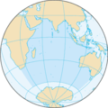
English: Map of The Indian Ocean (CIA FB 2002). |
| Source | The World Factbook |
| Author | United States Central Intelligence Agency |
| Other versions |
|
Licensing
[edit]| Public domainPublic domainfalsefalse |
This image is in the public domain because it contains materials that originally came from the United States Central Intelligence Agency's World Factbook.
Bahasa Indonesia ∙ čeština ∙ Deutsch ∙ eesti ∙ English ∙ español ∙ Esperanto ∙ français ∙ galego ∙ hrvatski ∙ italiano ∙ Nederlands ∙ norsk nynorsk ∙ polski ∙ português ∙ sicilianu ∙ slovenščina ∙ suomi ∙ Türkçe ∙ Zazaki ∙ беларуская (тарашкевіца) ∙ македонски ∙ русский ∙ српски / srpski ∙ українська ∙ ქართული ∙ বাংলা ∙ தமிழ் ∙ മലയാളം ∙ 한국어 ∙ 日本語 ∙ 中文 ∙ 中文(简体) ∙ 中文(繁體) ∙ العربية ∙ +/− |
 |
File history
Click on a date/time to view the file as it appeared at that time.
| Date/Time | Thumbnail | Dimensions | User | Comment | |
|---|---|---|---|---|---|
| current | 19:18, 27 August 2019 |  | 330 × 330 (11 KB) | Kaldari (talk | contribs) | Reverting for consistency with the other ocean map images. If you remove the background, please remove it from all 5. |
| 22:08, 13 March 2017 |  | 330 × 330 (11 KB) | WikiBunny2K1 (talk | contribs) | Transparent | |
| 20:16, 22 August 2009 |  | 330 × 330 (11 KB) | Serg!o (talk | contribs) | language neutral map | |
| 11:34, 27 August 2005 |  | 330 × 330 (11 KB) | ScribeOfTheNile~commonswiki (talk | contribs) | Recompressed with OptiPNG on maximum setting. 21.05% filesize decrease. | |
| 09:39, 3 November 2004 |  | 330 × 330 (14 KB) | Maximaximax (talk | contribs) | Map of The Indian Ocean (CIA FB 2002) {{PD-USGov}} |
You cannot overwrite this file.
File usage on Commons
The following 14 pages use this file:
- Atlas of the Oceans
- Indian Ocean
- Ocean maps
- User:Achim55/SVG replacements
- User:Ch1902/Top 200 Should be SVG
- File:Indian Ocean-CIA WFB Map.png
- File:Indian Ocean-hi.png
- File:Indianocean.PNG
- File:Indianocean.png
- File:Indischer Ozean.png
- File:Manovre modafeane velayate 90.png
- File:Samudra Hindia.png
- Template talk:Assessments/Archive 1
- Category:Indian Ocean
File usage on other wikis
The following other wikis use this file:
- Usage on af.wikipedia.org
- Usage on an.wikipedia.org
- Usage on arc.wikipedia.org
- Usage on ar.wikipedia.org
- سلطنة عمان
- اليمن
- جيبوتي
- جزر القمر
- الهند
- الصومال
- تنزانيا
- موزمبيق
- سريلانكا
- المحيط الهندي
- ماليزيا
- باكستان
- تايلاند
- أستراليا
- القارة القطبية الجنوبية
- تيمور الشرقية
- ميانمار
- إندونيسيا
- بنغلاديش
- المالديف
- جنوب إفريقيا
- سيشل
- مدغشقر
- موريشيوس
- زنجبار
- إرتريا
- مايوت
- لا ريونيون
- جزيرة كريسماس
- جزر كوكوس
- إقليم المحيط الهندي البريطاني
- لكشديب
- أراض فرنسية جنوبية وأنتارتيكية
- جزيرة هيرد وجزر ماكدونالد
- الإقليم الأسترالي في القارة القطبية الجنوبية
- أرخبيل تشاغوس
- بوابة:المحيط الهندي
- بوابة:المحيط الهندي/واجهة
- قالب:البلدان والأقاليم المتاخمة للمحيط الهندي
- العلاقات البنغالية اللبنانية
- ليبورني
- Usage on arz.wikipedia.org
- Usage on ast.wikipedia.org
- Usage on as.wikipedia.org
View more global usage of this file.
Metadata
This file contains additional information such as Exif metadata which may have been added by the digital camera, scanner, or software program used to create or digitize it. If the file has been modified from its original state, some details such as the timestamp may not fully reflect those of the original file. The timestamp is only as accurate as the clock in the camera, and it may be completely wrong.
| Horizontal resolution | 28.35 dpc |
|---|---|
| Vertical resolution | 28.35 dpc |


